This page is being developed to provide an overview of all active mining claims in the Gilmore area. It is currently a work in progress.
To contact me for any suggestions or corrections, please email JonWaraas@Gmail.com
Interesting Read -> How The BLM Mining Claim Process Works
Information Regarding Active Mining Claims:
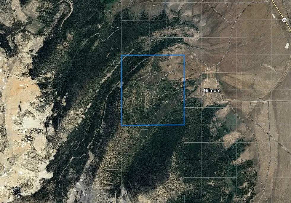
In the fall of 2021, Kennecott Exploration Company staked numerous mining claims across the public lands surrounding Gilmore, Idaho. By the summer of 2024, their core drilling operations were underway, with one vehicle observed in the area. The company has staked a significant portion of the public land around Gilmore.
For your convenience, detailed maps and locations of all their mining claims, obtained from the BLM, can be downloaded using the links below.
📄 Kennecott Mine Claim Maps
📄 Kennecott Mine Claim Location Info
Who Is Kennecott Exploration Company?
Kennecott Exploration Company is a subsidiary of Rio Tinto, a multinational corporation based in the United Kingdom and Australia. The company is involved in the exploration of mineral resources, with a particular focus on precious metals such as gold, silver, and copper. Kennecott’s operations often include staking mining claims, conducting geological surveys, and drilling to assess potential mineral deposits. The company has been active in various regions, including around Gilmore, Idaho, where it has staked numerous claims as part of its exploration efforts.
BLM Mining Claims – Key Terms
Claim Name
The unique identifier given to a mining claim. It often reflects the location, discovery, or a historical name associated with the claim.
Claim Type
This refers to the classification of the claim. Common types include lode claims, which are for mineral deposits found within bedrock, and placer claims, which are for minerals found in loose sediments such as rivers and streams.
Claim Size (Acres)
The total area covered by the mining claim, usually measured in acres. This indicates the land size the claimant has rights to extract minerals from.
Claim Case Number
A unique number assigned to each mining claim when it is filed. This number is used for tracking and legal purposes within the BLM database.
Link to Serial Register
A hyperlink that leads to the official BLM Serial Register page, where detailed information about the mining claim is stored, including legal status and history.
Claim Location Date
The date on which the mining claim was officially located and filed with the BLM. This date marks the beginning of the claimant’s legal rights to the land.
Township and Range
Refers to the system used to describe land locations in the U.S. using a grid system. “Township” refers to a 6-mile by 6-mile square area, and “Range” refers to the distance east or west from a meridian.
Section
In the context of land location, a section refers to a 1-mile by 1-mile square that makes up part of a township. There are 36 sections in each township.
Claimants
The individual or company who has staked the mining claim and has legal rights to the minerals on the land. Claimants are responsible for maintaining the claim and ensuring compliance with BLM regulations.
Section 18: